
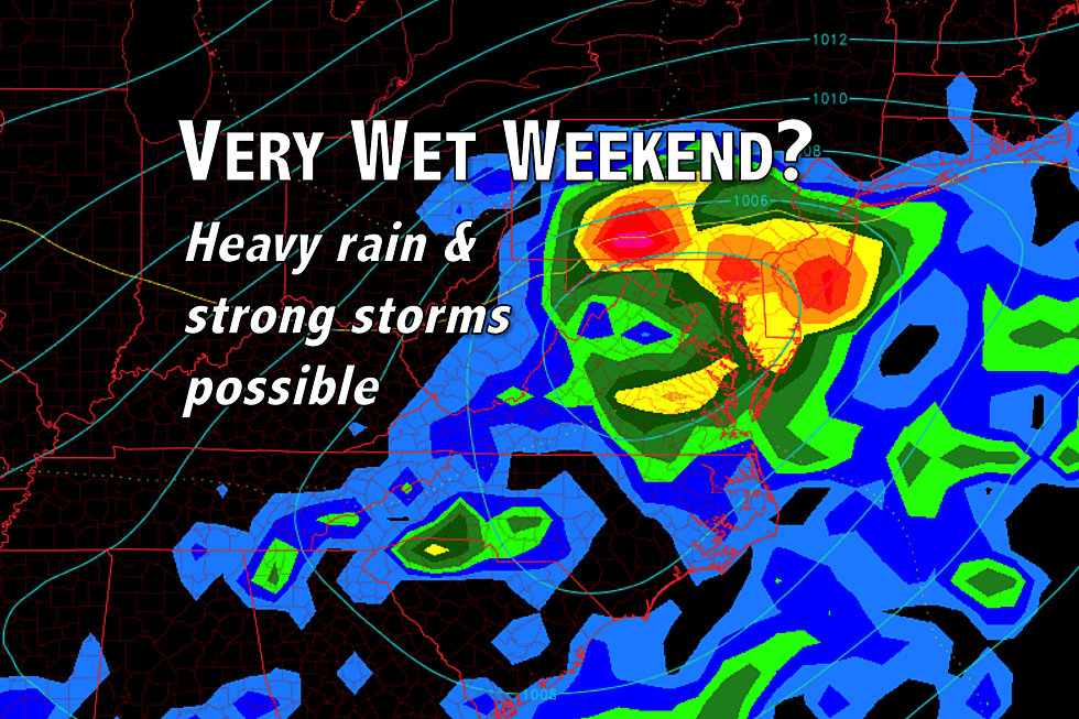
3 scenarios for NJ weekend coastal storm: Wet, wetter, wettest
The big questions: How much rain will fall, and when will the rain end?
Ugh. Just two days ago, I was promoting a stellar weather forecast for the weekend. While I had initially estimated and anticipated a storm system would stay off-shore, it now looks like it will pass right over New Jersey. (Call it a nor'easter if you must — I'm opting to skip the "buzz word" and call it a coastal storm.) Can we salvage part of the weekend? Maybe.
Thursday morning is starting out quiet and comfortable, with the coolest temperatures in the mid to upper 50s. We will get noticeably warmer and more humid compared to the past several days. Thursday's forecast high temperatures are mostly in the lower 80s. (The Jersey Shore will be a bit cooler, as usual.)
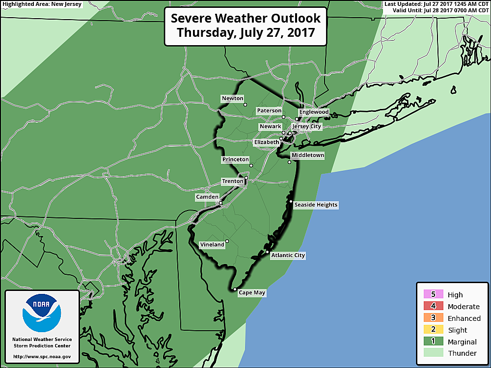
Skies will progress from partly to mostly cloudy by Thursday afternoon. As a weak front passes over the Garden State, a chance for a shower or thunderstorm enters the forecast. The best chance for raindrops will be around 5 p.m. — while a strong or severe storm cell is possible, it's worth noting that the overall chance of rain and potential severity of any storms have decreased in recent model runs.
Thursday night looks quiet, although a bit muggier than it has been. Lows will only fall to around 70 degrees, under mostly cloudy skies.
We'll continue to see lots of clouds overhead on Friday. Most of the day will be fairly quiet and fairly warm, with thermometers peaking in the lower to mid 80s.
And then along comes our coastal storm system, riding the aforementioned front like a runaway train on a one-way track. Soul Asylum references aside, it's becoming clear that at least part of the weekend will be wet for New Jersey.
I believe forecast models are painting three potential scenarios that could play out for the Friday-Saturday-Sunday time frame:
Scenario #1: Flop
How much rain will fall? Less than an inch.
When will the rain end? Early Saturday afternoon.
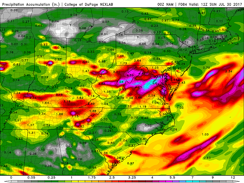
If you like sunshine, the NAM is your model friend. It's the only option that shows the heaviest rain staying away from New Jersey, with clearing skies through the second half of the weekend.
This forecast option keeps the greatest forcing (and therefore heaviest rain) south of New Jersey. In the image to the right, you can see total rainfall through Sunday averages just a half-inch across the Garden State. Meanwhile, the area southwest of Washington DC gets hammered with 6+ inches of rain.
Furthermore, this scenario allows the storm to easily exit the Northeast U.S. by Saturday afternoon. That would allow for clearing skies and warming temperatures. Sunday would be sunny and spectacular.
Scenario #2: Heavy Rain, then Clearing
How much rain will fall? Widespread 2 to 4 inches.
When will the rain end? Early Saturday afternoon.
This is the middle-of-the-road scenario. While the weekend would start with torrential downpours, it would end with brighter, warmer conditions. This scenario was depicted in previous GFS model runs, and the latest European ensemble continues to support it.
In this scenario, the track of the coastal storm passes right over New Jersey. That would produce some incredibly heavy rain, centered around early Saturday morning. Because our ground is still soaked from last week's rains, flash flooding would occur very quickly.
But this scenario carries good news too, as the storm system would kick out to sea Saturday afternoon. Even though Saturday would be at least a half-wash, Sunday would optimistically still be warmer, drier, and much more pleasant.
Scenario #3: Heavy Rain, then More Rain
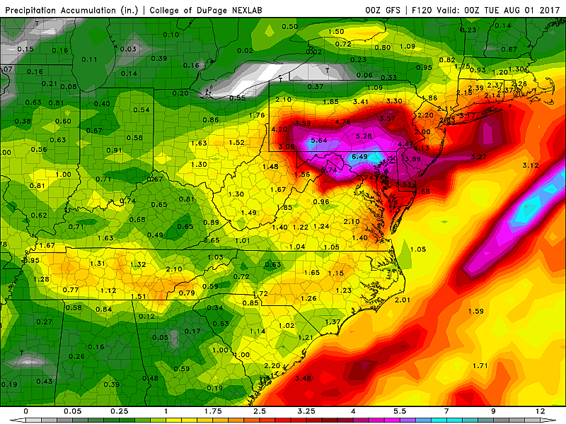
How much rain will fall? Widespread 2 to 4 inches, with locally high amounts (6+ inches).
When will the rain end? Early Monday morning.
Sigh. The weekend washout option. Both the operational GFS and European models now paint this picture.
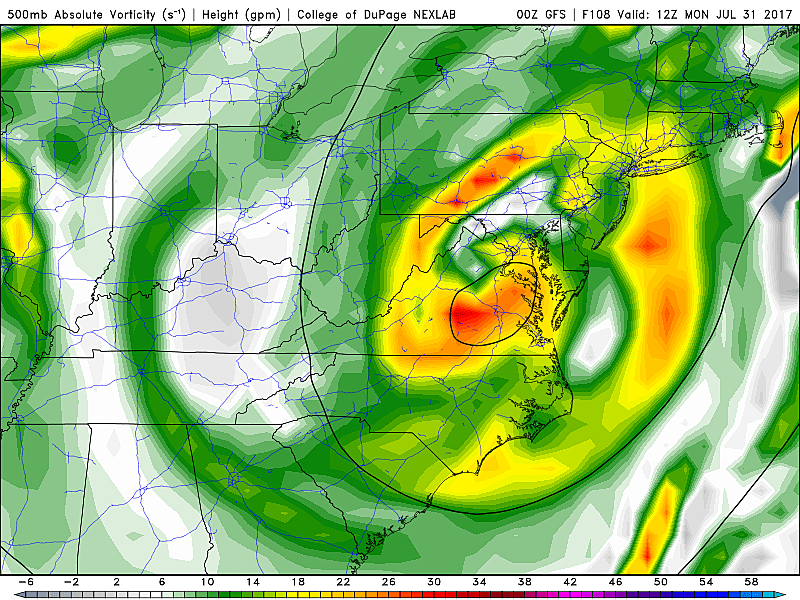
Just like Scenario #2 above, the center of the storm system tracks directly over (or very close to) the Garden State. But instead of kicking out to sea after drenching the state, the coastal low gets "stuck". It looks like the upper-air flow — a "blocking" pattern attributed to the position and strength of the Bermuda high — would keep the system over the Northeast U.S. through Sunday. And Monday.
That means the rain will just keep on falling throughout Sunday, leading to an inevitable weekend washout for part, if not most, of New Jersey. I've seen models suggest that some spots in New Jersey could see upwards of 6.5 inches of rain over a span of 48 hours. A true deluge, which would exceed the 10-year storm amount. Again, flash and river flooding could be a big problem.
Other Considerations
--Severe Weather: Strong to severe embedded thunderstorms are certainly possible, especially amongst the heaviest rain bands Saturday morning. Gusty winds and hail would be the biggest concerns.
--Wind: No matter which scenario plays out, Saturday looks pretty windy due to pressure gradient force alone. My estimation shows sustained northeasterly winds at 15 to 25 mph, with gusts up to 40 mph. If the storm system gets stuck, Sunday would be windy as well.
--Down the Shore: Just like a wintertime nor'easter, this system could push significant ocean water toward the Jersey Shore, raising concerns for coastal flooding and beach erosion. It's still unclear how much surge and which category of flooding (minor, moderate, major) will occur — that will become clearer soon.
--Confidence: Again, I have to stress that forecast uncertainty is high and confidence remains fairly low. I'm literally 50/50 over scenario 1/2 vs. the washout scenario 3. Don't cancel your weekend plans yet, but be ready to stay flexible as we tip the scales with new information from the next model runs Thursday afternoon and Friday morning.
I'll be watching this complicated and volatile weather situation very carefully in the coming days. Look for social media updates throughout Thursday. My next weather blog update will be published by 7 a.m. Friday.
More From Lite 96.9 WFPG


