Thursday NJ weather: Heat wave ends, rain arrives, Tropical Storm Isaias
The Bottom Line
We're about to transition from heat to rain, as a frontal boundary slides back toward New Jersey. A batch of steady rain Thursday night will kick off an extended string of generally unsettled weather, with occasional thunderstorms. There is a rain chance in the forecast for each of the next seven days (at least).
We're also carefully watching newly upgraded Tropical Storm Isaias in the Caribbean Sea, as forecast models show a closer approach to the U.S. East Coast, including New Jersey. (More info in the "Monday" section below.)
Thursday
We're starting off with fairly comfortable conditions across New Jersey, thanks to a taste of drier air. Morning low temperatures average 70 degrees from top to bottom across the state. It is going to be another hot day, as highs soar to about 90 to 95 degrees for most. This will be the 7th and final consecutive day with 90+ degrees somewhere in New Jersey.
So the first half of the day looks fine — hot, with increasing clouds, and a southwesterly breeze. Then starting around mid-afternoon (3 p.m.) we could see some spotty showers and thunderstorms pop up, centered on the middle part of the state.
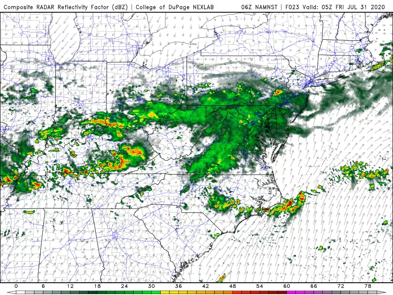
The better chance of rain will arrive Thursday evening. And it looks like we're really going to get soaked through the overnight hours, with a round of steady rain driving from west to east across New Jersey. There could be some pockets of heavier rain and rumbles of thunder embedded in this storm system too, especially across central and southern NJ. Overnight low temperatures will drop to the lower 70s.
Friday
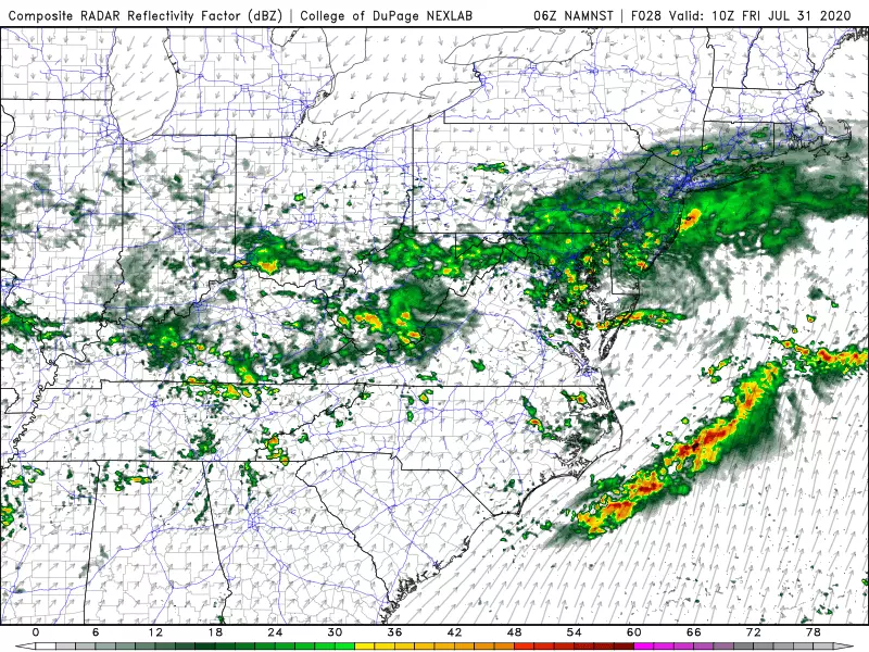
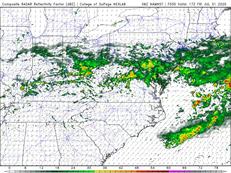
In a bit of a change from our previous thinking, Friday is looking rather wet now. Steady rain looks to largely continue through the morning. Lingering showers are possible into the afternoon, before we hopefully see some late-day clearing. Because of the raindrops and the clouds, high temperatures will struggle to warm past 80 degrees. No 90s.
Friday evening and Friday night look pretty nice though, even though the ground may still be wet. Relatively low humidity should allow temperatures to drop into the 60s (away from the coast) by Saturday morning.
Saturday
Happy August! Saturday will probably be the nicer day of the weekend, with partly sunny skies and seasonable high temperatures between about 85 and 90 degrees. The chance for a shower or thunderstorm during the day isn't quite zero, but I'd categorize it as low. The threat for a thunderstorm with heavy rain will be much greater Saturday night.
Sunday
More humid, with more clouds. And warmer, with high temperatures popping to about the 90 degree mark (away from the Shore). And there could be a few showers and thunderstorms around too.
Monday
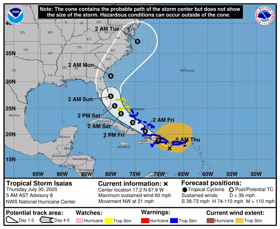
OK, let's talk about Tropical Storm Isaias. (Again, that is pronounced ees-ah-EE-ahs.)
As of 5 a.m. Thursday, the storm is centered just southwest of Puerto Rico, about 1,600 miles south-southeast of New Jersey. With maximum sustained winds of 60 mph, it is firmly a tropical storm. And it will maintain that strength as it makes landfall on Hispaniola later Thursday, and as it moves through the Bahamas on Friday and Saturday.
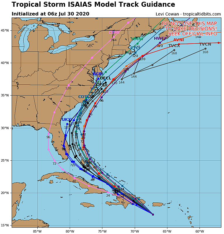
Hurricane forecast tracks are generally very accurate within about 3 days. That brings Isaiah's center right along the Atlantic coast of Florida. How far away from the coastline the storm stays will be key in the degree of potential impacts here in New Jersey. Will the storm feed on enough warm ocean water to intensify into a hurricane? Will the storm hug the coast, or swing out to sea? How big will the storm be? On which side of the storm will the heaviest rain and wind end up?
The answers to those questions will become clearer in the next 24 to 36 hours. To be frank, current model consensus puts Isaias within close proximity of the Jersey Shore in the Monday-Tuesday time frame. That is a precarious position. Rough surf and minor surge is almost a guarantee on such a trajectory. If it wiggles a little bit closer, we may have to talk about some wind and rain too.
Will Isaias turn into a "monster" storm? Unlikely. Could we see some minor to moderate impacts here in New Jersey? Yup. Worth watching closely? Absolutely.
The Extended Forecast
It's not even going to attempt specific details for Monday, Tuesday, and beyond given the uncertainty surrounding Tropical Storm Isaias. It will probably be warm, unsettled, and humid. In other words — summer-ish.
More From Lite 96.9 WFPG