Wednesday Storm Expected to Complicate Thanksgiving Travel
Wintry weather could cause hazardous travel conditions for those planning to hit the road this Thanksgiving, according toTownsquare Meteorologist Dan Zarrow.
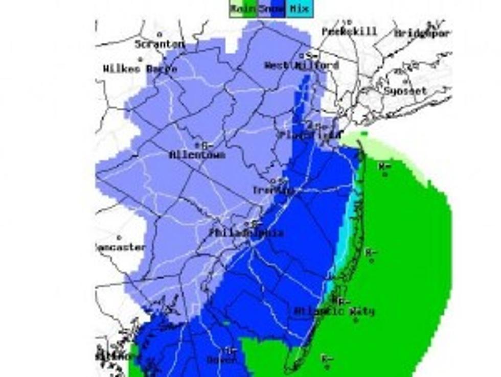
National Weather Service map precipitation map for Wednesday night at 7 p.m. (NWS)Zarrow says there is a possibility for snow accumulations as the holiday approaches.
Dan's forecast for South Jersey calls for rain beginning Wednesday morning, then mixing with snow by afternoon. A coating to an inch of accumulation is possible locally. However, if you plan to travel to our north or west, you could encounter more accumulating snow.
“There is still a lot of uncertainty with this system,” Zarrow said Sunday. “If it weren’t one of the biggest travel weeks of the year, I (and other forecasters you’ve seen post things online) would not give this any real substance until tomorrow. At this point, I’m willing to admit there is a chance for 3-6 inches of snow accumulation.”
The National Weather Service in Mt. Holly is calling for a 70 percent chance of rain and snow before 9 a.m. on Wednesday, then rain with a high temperature of 42 degrees. For Wednesday night, the NWS predicts a 50 percent chance of rain and snow, followed by clouds and temperatures around 30 degrees.
“No matter what kind of precipitation this storm system spits out and exactly where, there will be big-time travel headaches,” Zarrow said.
AAA is predicting that approximately 1.2 million New Jerseyans will travel 50 miles or more from home during the Thanksgiving holiday weekend, up 4.1 percent from 2013. In fact, Thanksgiving holiday travel volume is expected to reach the highest level since 2007.
Here is the latest regional forecast from the National Weather Service.
Low pressure is forecast to develop over the eastern Gulf of Mexico on Tuesday night. The low is expected to intensify as it tracks north northeastward along the East Coast. The center of the low is anticipated to pass over the waters off Delaware and New Jersey on Wednesday evening before reaching New England and its coastal waters late on Wednesday night.
Precipitation is forecast to overspread our region from the south on Wednesday morning. At this time, the precipitation is expected to be mainly rain during the daylight hours on Wednesday from the Interstate 95 corridor southeastward and mainly snow at locations well to the northwest, including parts of Berks County, the Lehigh Valley, the Poconos and northwestern New Jersey.
The rain-snow line is anticipated to move southeastward on Wednesday night with the rain changing to snow along the Interstate 95 corridor. The precipitation is forecast to come to an end in our region early on Thanksgiving morning.
Snowfall amounts of 4 inches or greater are possible to the northwest of the Interstate 95 corridor fromWednesday into Wednesday night.
The wintery precipitation has the potential to negatively impact the busy holiday travel period from Wednesdayinto Wednesday night.
Northerly winds are forecast to increase to 10 to 20 mph on Wednesday with gusts to 25 or 30 mph possible. The wind is expected to become northwest on Wednesday night.
Gale force wind gusts are possible on the coastal waters of New Jersey and Delaware from Wednesday into Wednesday night.
More From Lite 96.9 WFPG