South Jersey has been on a lucky streak when it comes to winter weather. Yesterday's storm wrecked havoc in central and northern New Jersey. Western Atlantic and Cumberland County only had a trace of snow.According to the National Weather Service the next storm will arrive late tonight...
Temps will be taking a nosedive for the next couple of days... We'll barley make it out of the teens for the highs and we'll be close to singe digits for the lows.
Atlantic and Cape May Counties got lucky with yesterday's storm. Most of the state had significant snowfall from Winter Storm Janus. The biggest amounts of snow fell in Monmouth County.
Enjoy the spring like temps that we've been enjoying the last couple of days. The dreaded Polar Vortex will make another appearance in South Jersey by the end of the week.
The National Weather Service in Mount Holly has issued a coastal flood warning for Cape May County and also issued a coastal flood advisory for Atlantic County.
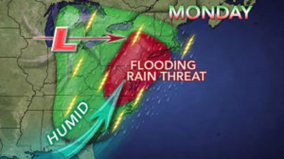
It's only been a few day since most of South Jersey was hit with heavy rain. Some areas received more than 3 inches of rainfall. It's looks like we could be in for another round of heavy rainfall.
Spring is officially here, arriving at 7:03 this morning. Unfortunately, it still feels like winter outside and we may be waiting awhile for warm spring like weather.
We're keeping our eye on a storm that could bring moderate to major coastal flooding to the New Jersey coast midweek. The National Weather Service in Mount Hollly
According to the National Weather Service temperatures will rise well into the 90's for the next couple of days as the Heat Wave for the summer of 2012 continues. The heat index will be close to 100!
Get ready for the first heat wave of the summer season! The National Weather Service has called for a excessive heat warning from 1PM Wednesday to 6am Friday.