
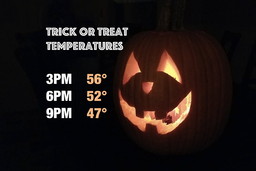
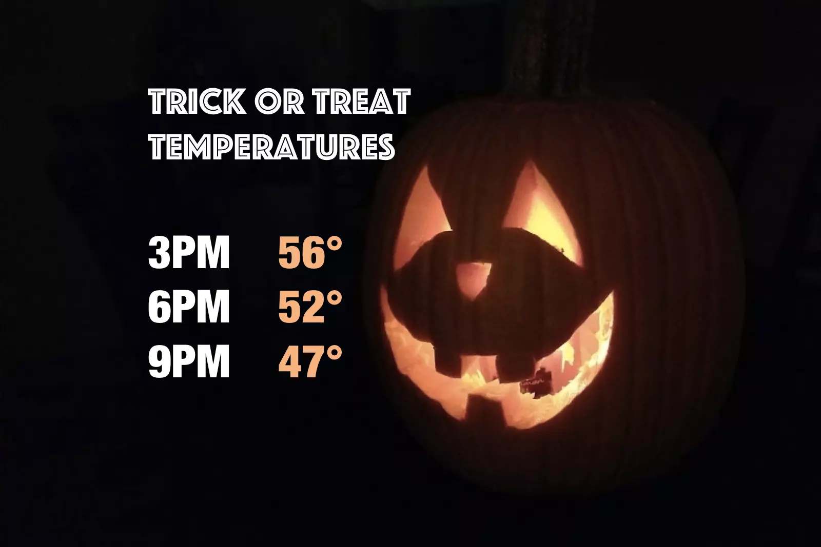
Sunny, breezy, and cool Halloween weather for NJ
You may want to add an extra layer of clothing under the costume, with a definite late October chill in the air.
Here are your weather headlines for Tuesday, October 31, 2017...
Halloween: Sunny, but Cool
Happy Halloween! As we dive into the final day of October, it's going to look like a pleasant weather day, with abundant sunshine all day. (There may be a few inconsequential clouds along the way.) However, the chilly in the air may send shivers down your spine when trick-or-treating with the kiddos later on.
High temperatures for Tuesday will be limited to about 55 to 60 degrees, just shy of normal for this time of year. Additionally, it will still be a bit windy through Tuesday afternoon, with potential gusts as high as 30 mph. We technically don't calculate "wind chill" until the thermometer dips to 40 degrees or below — but that brisk wind will definitely make the day feel blustery and chilly.
Temperatures will nosedive Tuesday evening, and it may turn into one of the coldest nights of the season so far. As lows dip into the mid to upper 30s, a widespread frost will be possible. Urban and coastal areas will be a bit warmer, in the lower 40s. The coldest spots — the higher elevations of NW NJ and the Pine Barrens — may experience a light freeze Wednesday morning.
Wednesday: Cloudy, Damp, and Cool
Clouds will increase by daybreak Wednesday, enacting a series of mostly cloudy days through the end of the week. Wednesday turns a bit unsettled, as a warm front lifts northward toward New Jersey. Some light shower activity will be possible. Rainfall totals will probably stay less than a tenth of an inch, so it'll be nuisance rain (if anything at all).
It's going to be another cool day, with afternoon highs only reaching the mid 50s. The temperature forecast for Wednesday night will be a little odd, as the effects of that warm front make themselves known. Temperatures will probably rise overnight, into the 60s by Thursday morning.
Warming Up
Thursday's high temperatures will be significantly warmer than earlier in the week. Look for temps near 70 degrees. Clouds will continue to win the sky, with a light southerly breeze.
Friday will probably be the warmest day of the week, as most thermometers break the 70 degree mark. It'll still be mostly cloudy, but the above normal temperatures will more than make up for any grey overhead.
Cooling Down
Sometime late Friday, a cold front will put an end to our temporary warmup. At the moment, this frontal passage looks dry — although in yesterday's forecast, it was anything but.
The most important result of this front, of course, will be cooler temperatures for the weekend. We'll top out around 60 degrees on Saturday, and only mid 50s on Sunday. Still mostly cloudy, thanks to a persistent on-shore flow. And there will potentially be a few showers around for both days, although I'm not prepared to pinpoint timing and location just yet.
More From Lite 96.9 WFPG


