

Monday weather for NJ: Drying out, cooling down
Since this is my first weather blog entry of the new month, allow me to wish you a Happy December! This month begins with a normal high temperature near 50 degrees, descending to the lower 40s by New Year's. Normal low temperatures similar decline from lower 30s to mid 20s. December is New Jersey's 4rd driest (9th wettest) month of the year, averaging 3.85 inches of total precipitation. (Of course, keep in mind 9 of the 11 months of 2018 have featured above-normal price.)
December 1 was also the start of climatological winter. In the weather and climate world, we use full calendar months (rather than the more well-known "astronomical" dates) to calculate statistics — it just makes the math cleaner and easier. So, climatological winter runs through December-January-February (also known as "DJF," by the way).
Our short-term forecast shows that Monday will be transition day — from damp warmth, to chilly dryness. For the rest of the week, I'm seeing chilly temperatures, but also almost completely dry weather.
Believe it or not, we tied the daily record high temperature at Atlantic City Airport — at 10:30 at night, it was 64 degrees! Temperatures on this Monday morning are generally in the 50s, and there is still some foggy, misty, drizzly blech hanging over the state.
A Dense Fog Advisory is posted until 7 a.m. for northeastern New Jersey (Bergen, Essex, Hudson, Passaic, and Union). It's also worth noting that a Flood Warning continues for the Passaic River at Pine Brook in North Jersey. Even after a trio of heavy rain events in the last week-and-a-half, it's hard to believe that waterways are still running high.
All signs are pointing to visibility and general weather conditions improving by about 10 a.m. Monday at the latest. Increasing sunshine is expected by Monday afternoon. However, a brisk wind will also kick up (as high as 30 mph) by midday, bringing chilly air back into the Garden State.
I'm thinking thermometers will hold steady in the mid 50s until Monday early afternoon, before starting their inevitable tumble. It might feel a bit blustery by Monday evening, with overnight low temperatures descending to the mid 30s across most of the state. I would expect a light freeze in NW NJ.
In terms of any rain or snow chances, they are really minimal. A band of precipitation will try to encroach upon northern New Jersey in the Monday night to Tuesday time frame — but that's going to produce a shower, at best.
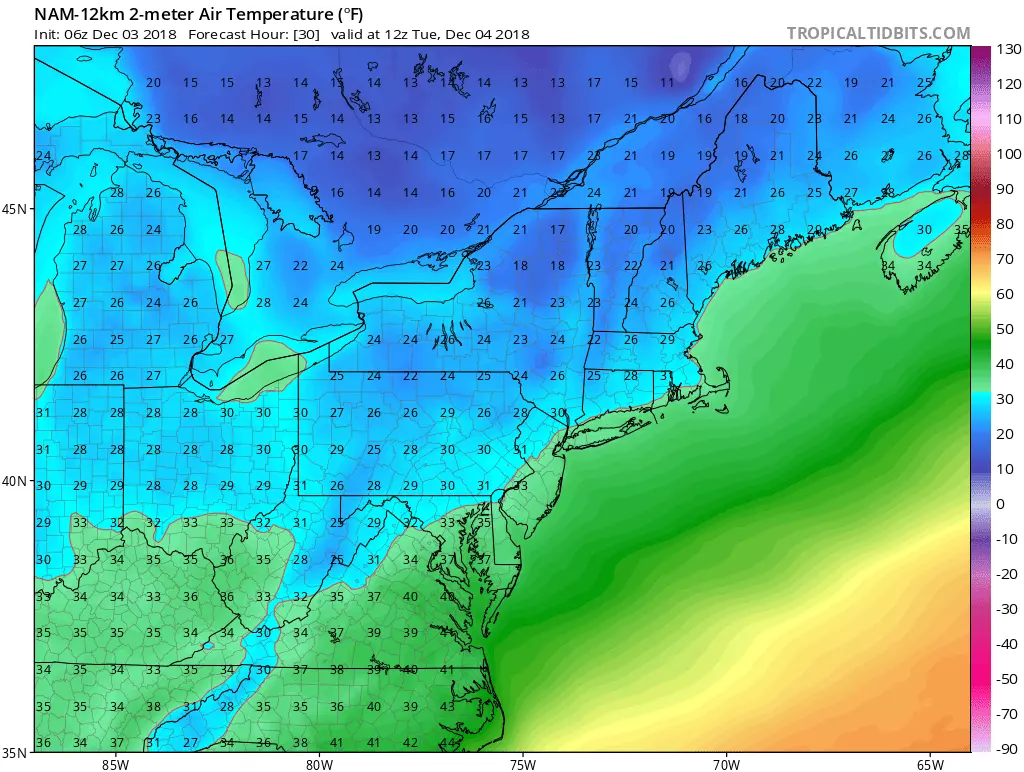
So Tuesday will feel very different than the past few days, with a renewed chilly in the air. Skies should be bright and sunny, and I think the wind will remain elevated (with gusts to about 25 mph). High temperatures will only reach the lower 40s — back to "bundle up" below-normal status.
Even as winds lighten up, Wednesday looks even colder, as thermometers barely reach 40 degrees under a mix of sun and clouds.
And we'll pick up a stiff breeze again on Thursday under partly sunny skies, with high temps in the lower to (maybe) mid 40s.
A cold frontal passage late Thursday to early Friday also looks dry, although certainly noticeable with even colder temps arriving by the weekend. (Highs in the 30s?)
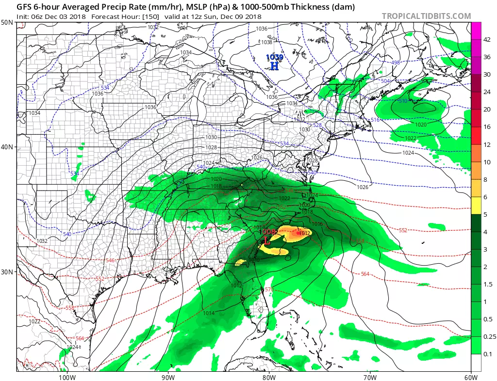
The next substantial storm system to watch is currently forecast to pass south of New Jersey this weekend too. One of two things will happen here:
1.) The storm stays south. That puts NJ on the colder northern edge of the storm leading to a pretty cold weekend. This is currently the model consensus.
2.) The storm turns up the coast, similar to a classic nor'easter track. That would bring precipitation — possibly wintry — into our neighborhood, sometime between late Saturday and early Monday.
If that weekend storm ends up missing New Jersey, we may enjoy a two-week stretch of mostly dry weather for a change. (Fingers crossed!)
More From Lite 96.9 WFPG


